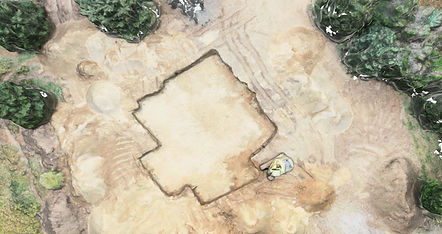
3D MAPPING
Let us take flight and create a 2D Orthomosaic map or a 3D model of your project in order to deliver to you precise measurements and clear land boundaries. When we fly up over your project we will capture images of the entire area, and use them to create an in depth map to help you visualize the entire project and save time in planning your next step. Click here to see an example of 3D model we've done!

JOB SITE PROGRESSION
Let us help your construction team by giving you real time progression analysis of your work sites. We will fly over and take images of your entire site and convert them into reports to determine what your best and cost effective options will be. Keeping your job site safe and working effectively while saving you time and money.
VOLUMETRIC MEASURING
Construction pros spend 14+ hours a week on activities that can be better managed with drone monitoring. Utilizing our Drone Data can deliver all of the necessary information on your construction site such as materials on hand, equipment and workers. We can even get you a report detailing how much volume is in a dirt pile, taking the guess work out of every project.


SMART SITE SUPERVISION
It no longer has to be hard to know what is happening on your construction site. Aerial drone data is revolutionizing measurement and management to improve efficiency and reduce safety risks. Work site injuries can set projects back 1 week or more resulting in budget over spending. Utilizing aerial smart site supervision increases safety standards by highlighting potential hazards.
CONSTRUCTION SITE ANALYSIS
Our collected data reports will help you provide the key information about your projects to your team. We can provide insights about the terrain, potential flooding zones and problematic areas before the start of a job. This information is essential to contractors as these problems typically aren’t found until later on and can cost up to three times the estimated job cost.


QUALITY CONTROL MONITORING
On average typical construction projects run 80% over budget and 20% behind schedule. Quality Control Monitoring closes the gap by providing crucial information to your entire team. Providing weekly data insights transforms how all components of your team work together; saving 13-21% of time spent strategizing during the construction phase.
ROOF INSPECTIONS
We know that natural disaster can strike at anytime. Take the danger out of roof inspections, and hire us! We can fly up over any building, gather some images and then compile a report about where the damages are. With accurate reporting, you'll never have to worry about whether something was missed.


COMMERCIAL REAL ESTATE
We know that when selling Commercial, its crucial for buyers to see the property they're planning to buy. TFDS can supply those angles with perfect precision. We can fly up and get crystal clear video and images of the building, intersection, parking lot and more.
RESIDENTIAL REAL ESTATE
TFDS will work with realtors to take seductively vivid images of residential properties to sell. Take control of the home you're selling, by enticing buyers with our beautifully still photos and videos.


AERIAL CROP MONITORING
We are very passionate about helping farmers get their best harvest. When we take flight over your crop, we will capture images and create a comprehensive Normalized Difference Vegetation Index (NDVI) map during our initial visit helping you identify any problem areas. Monitoring your crop weekly will allow you the opportunity to address any minor issues before they become costly. We also offer after storm monitoring!